Bus Routes


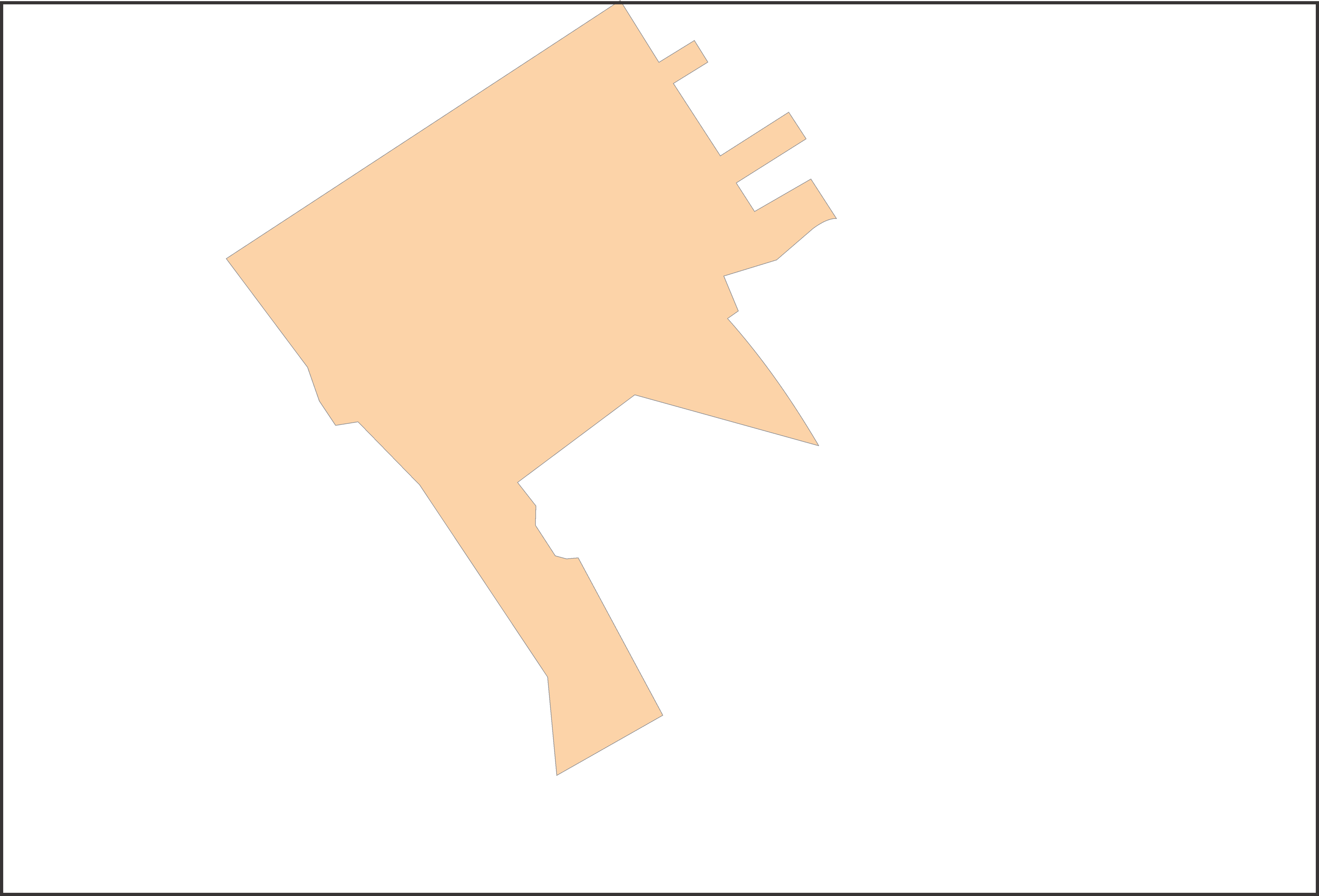

The VNC Region: (Venice Neighborhood Council ) represents the community within the highlighted area of the City of Los Angeles as defined in the Charter, section Xi. This section described the responsibilities of the neighborhood councils and the Department of Neighborhood Empowerment. Basically, the VNC is allowed to make official recommendations to the City Council and Mayor in the form of Community Impact Statements, but lacks any ability to take direct action. The VNC is funded through the City budget and the Officers are all elected bi-annually.
The VCZ (Venice Coastal Zone) layer highlights the land area within the VNC region that falls under the control of both the City of Los Angeles as well as the California Coastal Commission . Within this area all projects must get commission clearance permits prior to any development. The laws that govern these permits is defined in the 2001 Certified Venice Coastal Zone Land Use Plan (LUP). This plan defines character, scale and mass of land use which is further defined by subarea.
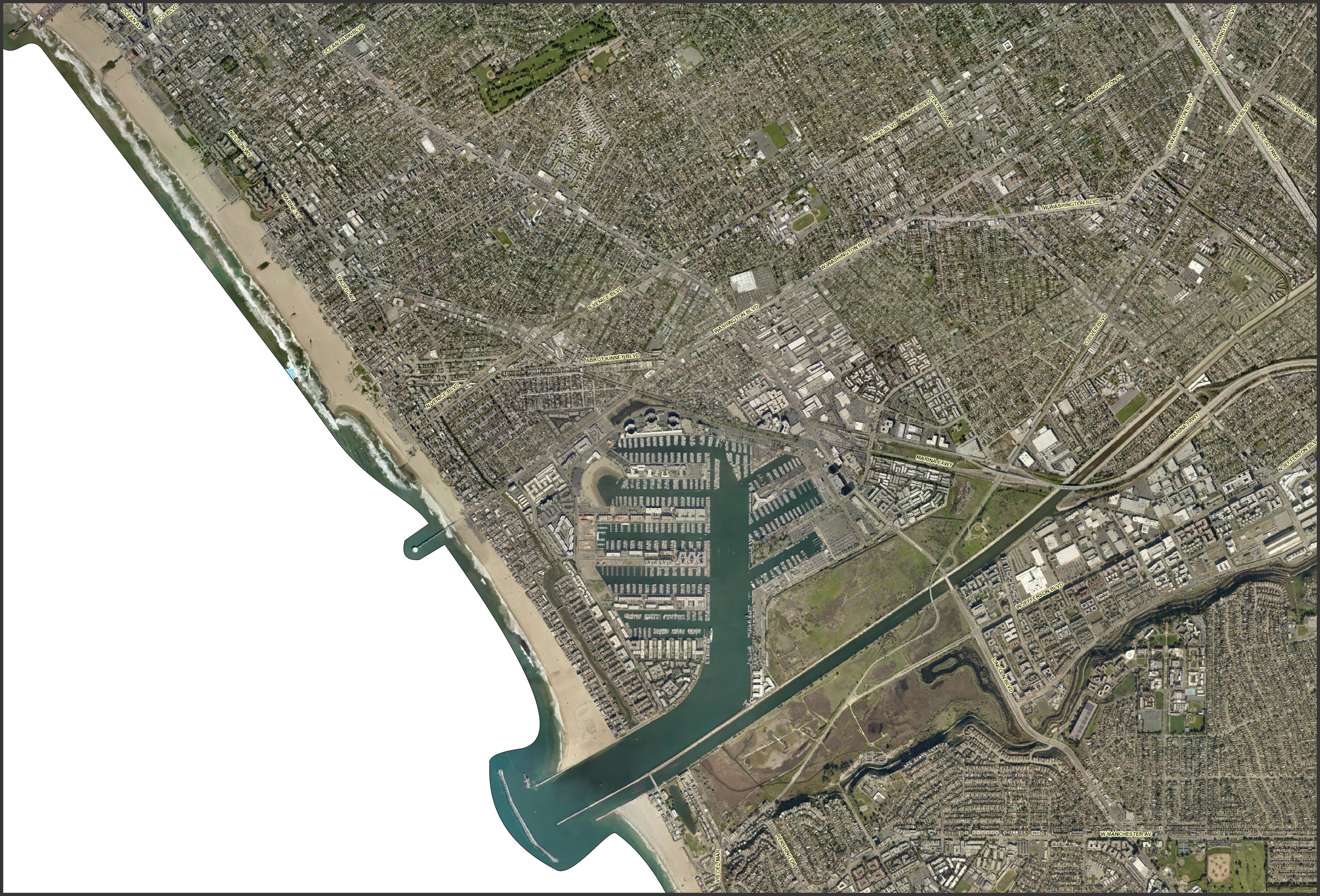
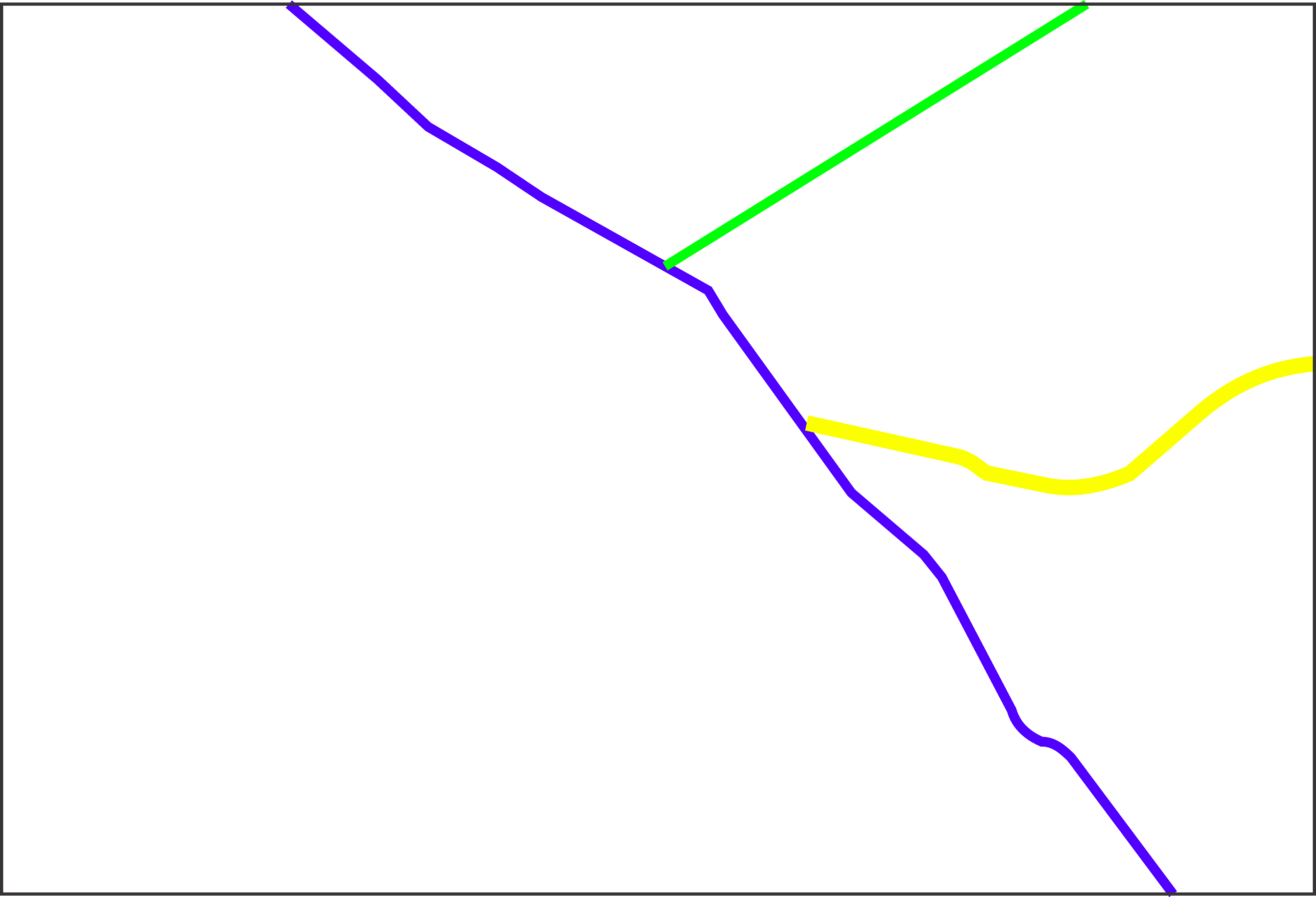
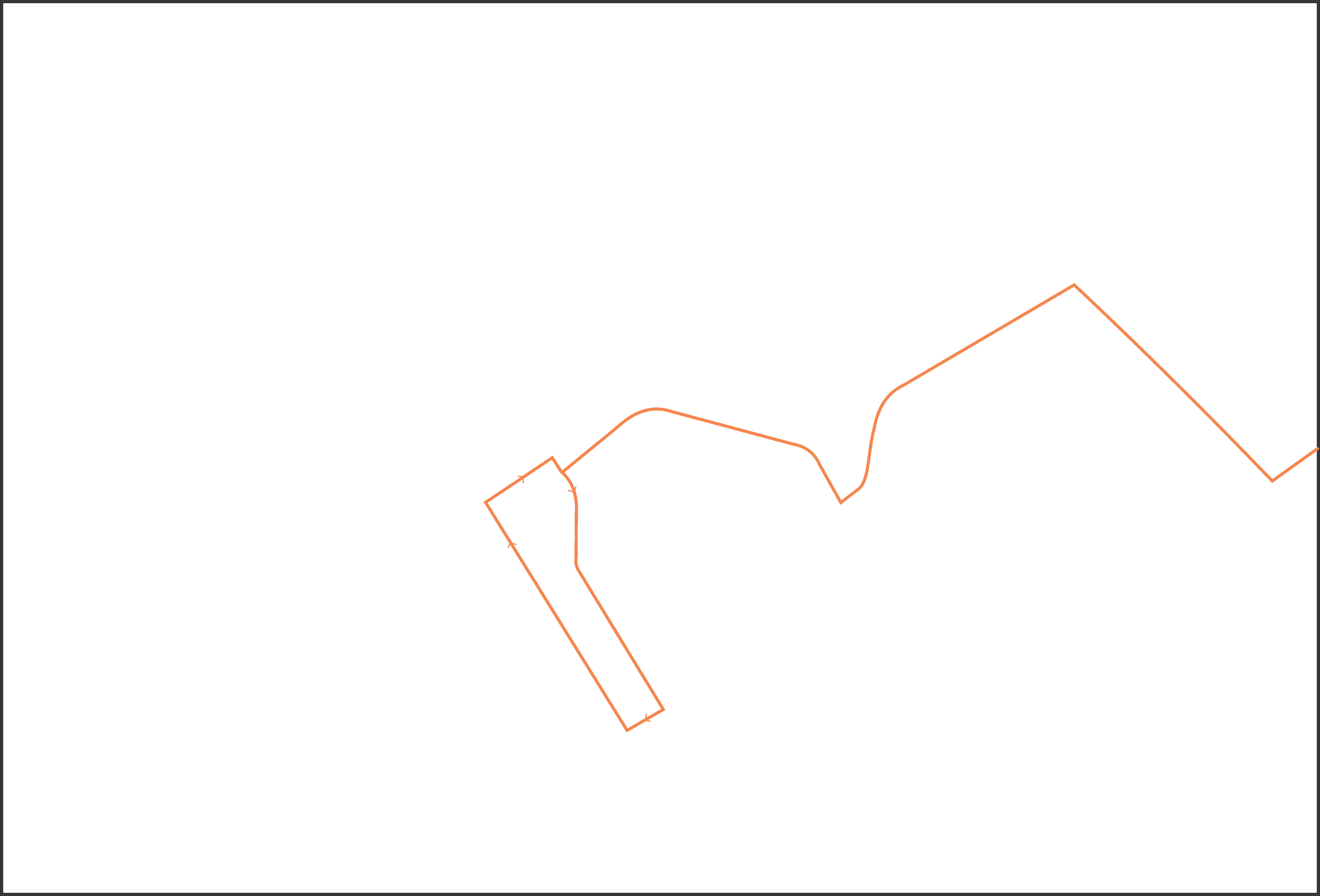
The Primary Routes layer highlights the two most major thoroughfares in the VNC region. In the North/South direction is Lincoln Blvd. (blue, aka California Route #1 and under joint jurisdiction of LA City and Caltrans) and in the East/West direction is Venice Blvd. (green, formally California Highway #187). Both roads are classified by LA Department of Transportation (LADOT) as primary regional routes of travel. A third roadway (highlighted in yellow) is the 90 West Caltrans freeway which terminates at Lincoln Blvd. At present, the land west of Culver Blvd. is made up of native plants, an RV storage yard (formerly a tennis camp), a commercial nursery and a parking lot for Marina Toyota. These uses are all considered temporary since this land was purchased with funds designated for transportation uses. Both Lincoln Blvd. and Venice Blvd. currently run Express high capacity bus routes.
The three beach parking lots that are located at the end of Rose Ave (288), Venice Blvd. (303) and Washington Blvd.(380) are owned by the City, but leased to and operated by the County. These lots are defined in the Venice LUP (Land Use Plan) as beach visitor parking. The number of stalls in each lot is shown above within parentheses. The fourth location that is highlighted connects Pacific Ave. to Via Marina and runs parallel to the Marina Del Rey main channel. Approximately 30 parking spaces are regulated by parking meters at this location.
The LA Department of Transportation, Off Street Division operates eight lots within the VNC region. They are shown on the map with a red outline and a white fill and following list breaks down the stall count by location:
- LADOT 613, Pisani Pl (55 stalls)
- LADOT 616, Electric Ave / California Ave (29 stalls)
- LADOT 617, Electric Ave / Milwood Ave (22 talls)
- LADOT 701, Venice Blvd / Dell Ave (150 stalls)
- LADOT 731 Venice Blvd / Pacific Ave (177 stalls)
- LADOT 740, Rose Ave at Main St (41 stalls)
- LADOT 759, Electric Ave / Santa Clara Ave (60 stalls)
- LADOT 760, Tabor Ct / Milwood Ave (55 Stalls)
- LADOT 761, Windward Ave / Pacific Ave (14 stalls)
- Oakwood Park / Rec Center (5 stalls)
- Penmar Park / Rec Center (46 stalls)
- Penmar Park, Golf Course (89 stalls)
- Westminster Park / Dog Park / Rec Center (22 stalls)
The Venice business corridors are shown in yellow on the map and are further defined by zoning regulations in the LUP. The streets include Ocean Front Walk, Lincoln Blvd., Rose Ave., Main St., Washington Blvd., Abbot Kinney Blvd., Pacific Ave. and Windward Ave.
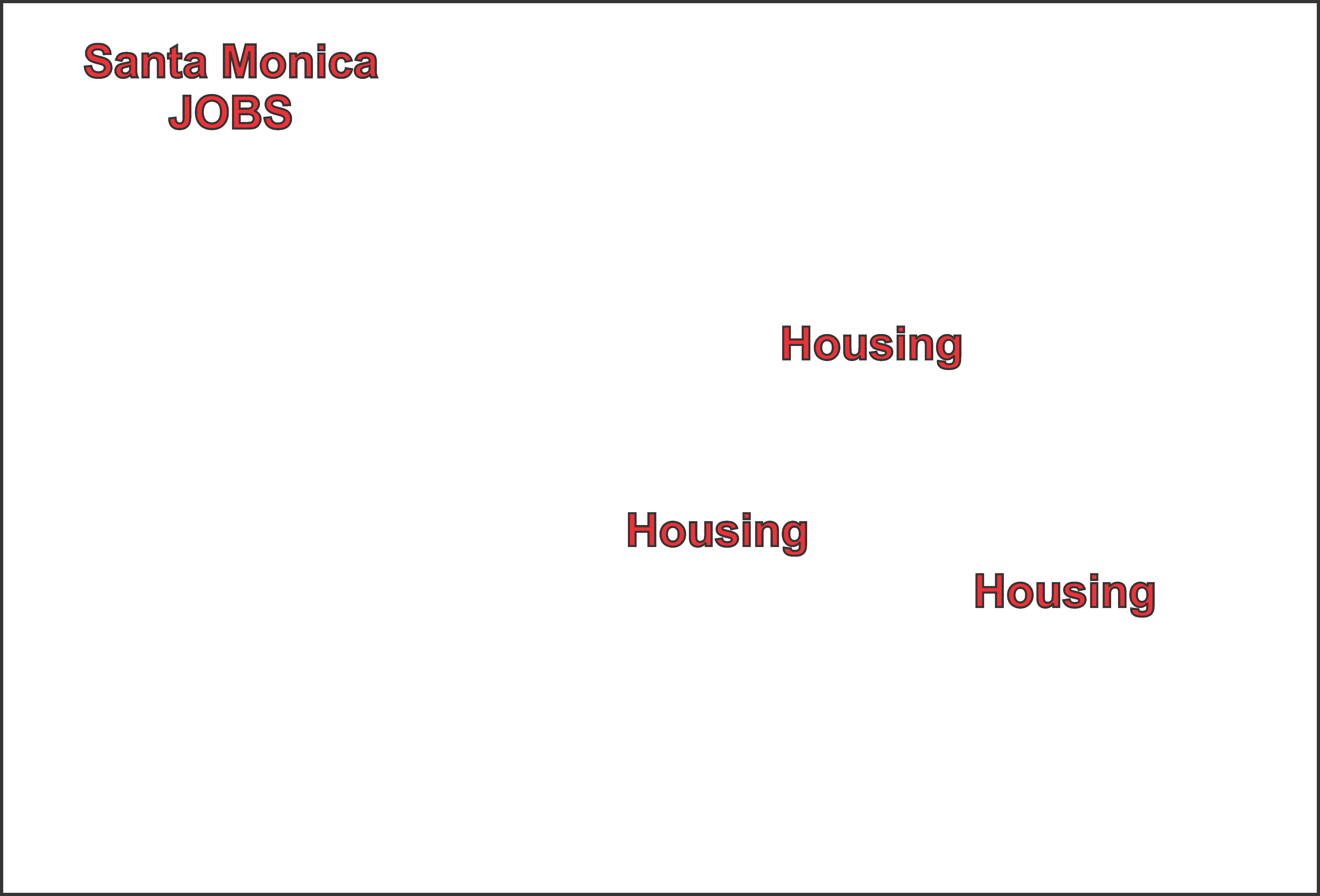
Commuter traffic through the Venice region primarily travels from the south to the north during the morning peak traffic hours and from north to south during the afternoon peak traffic hours. The large housing areas immediately to the south of Venice include Playa Vista (30k units), Del Rey (25k units) and Marina Del Rey (20k units). Additionally, the 90 West freeway, which terminates at Lincoln Blvd., directly connects several residential neighborhoods in Culver City and Ladera Heights. Abutting Venice to the north is the City of Santa Monica, an area that over the past ten years has created over 100,000 new jobs, mostly in the technology and finance industries.
The City has two maintenance locations that include a building on San Juan Ave. and a compound on Abbot Kinney Blvd.
The site at 100 Sunset Ave is owned by Metro with a history dating back to a contract between the Los Angeles Pacific Railroad Company and "Venice of America", a California City, founded by Mr. Abbot Kinney and partners. The document that transferred the land, in exchange for passenger transportation service and a $1.00 token payment, was recorded in 1902. In 1904, Venice of America opened and visitors from downtown Los Angeles flocked to the destination ocean front community arriving by railroad.
In January 2016 Metro adopted a process to develop a long term project at the site, which is presently being used as a temporary homeless shelter. Proposals were submitted in 2019 after Metro conducted a public outreach effort to collect stakeholder participation. The joint development process required design considerations that include affordable housing, retail, office, recreation, parking and Metro’s transportation objectives.
90 West Park-n-Ride / Venice Shuttle proposal: the concept here is to provide a large amount of parking on the undeveloped Caltrans land at the end of the freeway and connect it to the Venice region with a bus that is dedicated to a relatively short route turning around at Windward Circle (aka downtown Venice). This site is an ideal location for a regional transportation station, especially because it is located on Lincoln Blvd., which connects between Santa Monica Expo Metro Station and LAX and beach cities to the south.
The Lincoln Blvd. / Culver Blvd. overpass bridge was proposed in 2018 by Caltrans, and is currently in the planning stages of development. The intentions include widening the existing non-standard five lane north/south roadway to eleven lanes with a pike lane and sidewalks in both directions. Once completed, this bottleneck will eliminate a lot of traffic congestion that currently exists getting to and from the 90 West termination. However, the next bottleneck occurs at Washington Blvd., where Lincoln Blvd. narrows to five lanes, parking and sidewalks.

The proposed parking structure would offer storage for approximately 700 cars as well as an outdoor area for a few over height vehicles. The parking structure would be constructed to the east of the canal, with the land to the west to become an outdoor open air park abutting the canal, thereby not imposing any shadows on the canal in the afternoon when visitors are most likely to visit.
By creating this parking structure within the VCZ (Venice Coastal Zone), the Coastal Commission has indicated these spaces could be used to meet their preferential parking (aka permit parking) requirement to replace public on-street parking. Additionally, this structure could provide the badly needed off-site commercial parking that would allow an in-lieu parking plan as documented by the 2012 WLA Mobility Transportation Plan for Venice In-Lieu Parking.
The fees collected from these two uses could not only fund the construction of the structure, but the plan describes how a local shuttle could circulate through the Venice commercial corridors, thereby connecting visitor parking to local businesses.
Bus Layover Zones in Venice have been a problem for many years. The local residents and businesses feel overwhelmed by the smelly oversized vehicles of the three major bus lines that serve Venice, as well as the sightseeing buses. The proposal to address this condition is as follows:
Sightseeing buses will be limited in the Pacific Ave. and Windward Ave. area to loading and unloading only. Any buses standing there for more than five minutes will be cited with a whopping ticket, set high enough that receiving one will make violators think twice before writing the fine off as a cost of doing business. There are two strips of land on Venice Blvd. east of Abbot Kinney Blvd. that might be good locations for longer term Sightseeing buses to layover while their riders are visiting the community. Besides these two locations having ample space in an industrial zoned area of Venice, there is a quasi-public restroom at the public storage property (land use conditioned).
The long term MTA project at 100 Sunset Ave. should provide services for the public that can include bus layover parking. Clearly the buses that layover at this site today should be moved to unblock the bike lane which forces cyclists into the traffic lane.
The proposed layover zone on Washington Blvd. at the intersection of the bike path between Oxford Ave. and Palawan Way is away from all residential properties and a good location for buses to park while drivers are on their break. Restrooms would need to be added to this location.
The proposed site at Penmar Park is between two City owned sites: the Rec and Parks Center on the south and the Golf Course on the north. This location would provide bus drivers (route BBB #18 proposed) a rest stop where public restrooms already exist, and their buses would not be located near any residential properties.
Finally, the proposed transportation station at the 90 W freeway is an ideal layover zone to store buses and allow drivers to take their break. The proposed station should include public restrooms and other amenities, such as refreshments.
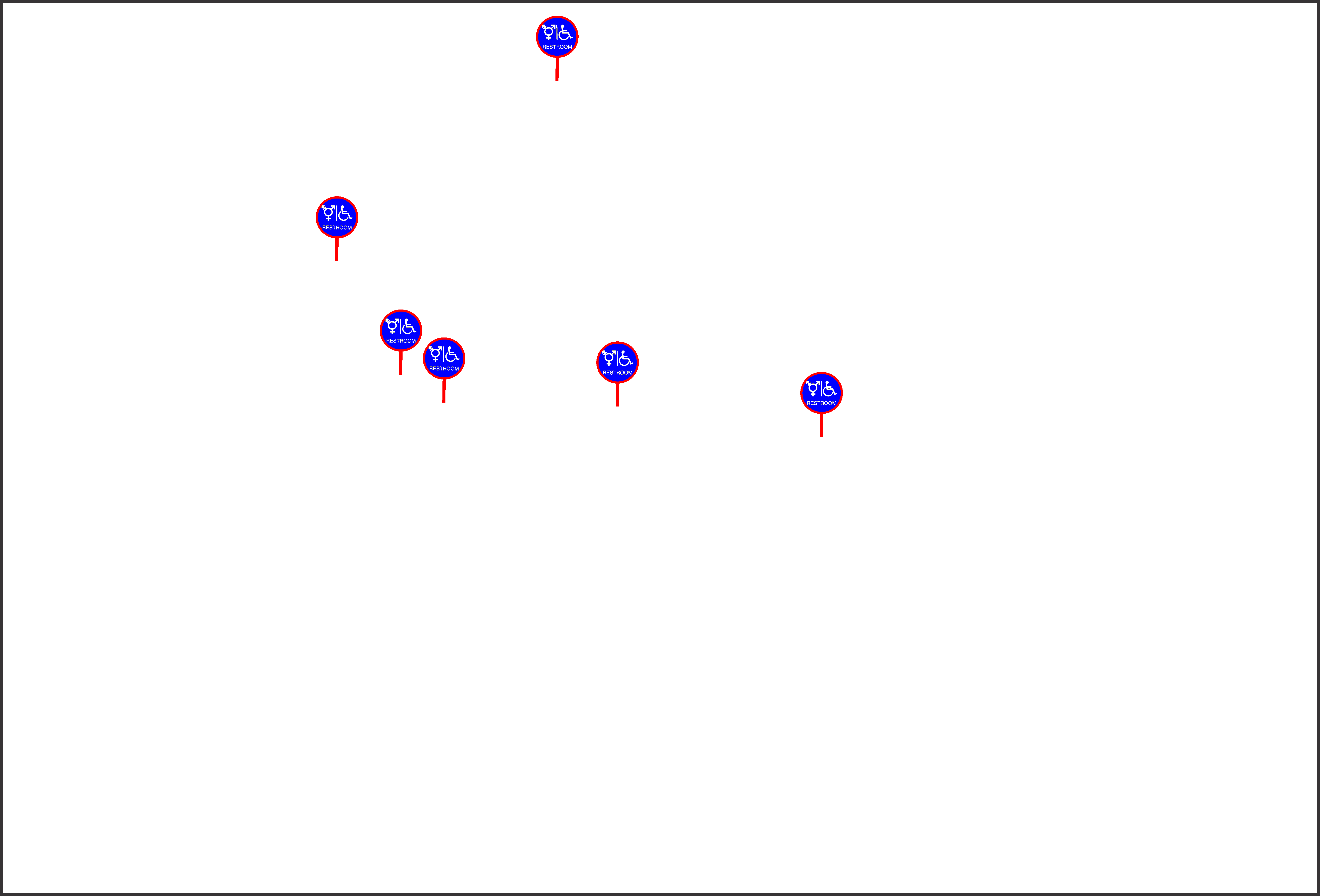
Venice beach and retail corridors are visitor destinations which require a minimum of public amenities and places where people who are walking can stop for a rest. In the larger sense of providing a transportation system for visitors, mass modal transit such as large buses bring riders into the area typically within one mile or less of their destination. These riders might have traveled for an hour or more before arriving and, depending on the returning bus schedule, may have to wait to depart for thirty minutes or more.
To address the basic humanitarian requirements that must be provided in an urban environment without burdening the private sector, the system needs to provide restrooms, water fountains, trash receptacles and shade structures where travelers can address their personal needs before transitioning to their next route on their journey.
Therefore, the three proposed transportation stations located at the 90 West, the MTA Sunset Ave., and the Venice Blvd. Parking Structure / Canal Park all need to incorporate these services. Additionally, the Bus Layover Zones need to provide similar services, which can be achieved at the Penmar location by Rec and Parks making their facilities available to bus drivers and the public. Additionally, the layover location on Washington Blvd. at the bike path intersection will need to be upgraded to address this requirement. Finally, the Windward Ave. / Pacific Ave. traffic island, where travelers visiting the downtown Venice area will arrive and depart, needs to be redesigned to provide a welcome experience including all of these basic amenities.
The Santa Monica, Big Blue Bus (BBB), Route #1 runs between the WLA UCLA Hilgard Ave.Terminal and Windward Circle in Venice. The frequency varies depending on the day of the week and time of day. A full schedule is available on their website.
This route duplicates the MTA #333 along Main St. between Windward Circle and the Santa Monica downtown Metro Expo station.
The Santa Monica, Big Blue Bus (BBB), Route #3 runs between the Santa Monica Metro Expo station and Metro Green Line at the Aviation / LAX Station. This route includes a standard local bus as well as a Rapid Express bus. A full schedule is available on their website.
The Santa Monica, Big Blue Bus (BBB), Route #18 runs between the WLA UCLA Hilgard Ave. Terminal and Marina Del Rey at Via Marina and Admiralty. This route enters Venice on the steep downhill of 4th St., turning east on Rose Ave. Once at 7th St., it turns south stopping three times in the Oakwood residential neighborhood before exiting onto Abbot Kinney Blvd. at California Ave. It then continues south on Abbot Kinney Blvd. making two more stops before reaching Washington Blvd., where it travels west to Marina Del Rey. The corner of California Ave. and Abbot Kinney Blvd. is an ongoing traffic congestion problem. Additionally, BBB has decided that the Windward Circle stop should be their Layover Zone, removing six or more public parking spaces off of the streets, where they stage three to five buses several times a day. The neighborhood around this area has complained several times about the odor and noise, as well as visibility blocked by these idling buses.
This proposed route for the BBB #18 interfaces with the Venice community in several advantageous ways. First, it enters Venice on a secondary highway by coming down the hill at 23rd Street - Walgrove Ave., and then turns west on Rose Ave., passing between Penmar park and the golf course and one short block from the largest affordable housing project in Venice: Lincoln Apartments at Lake Ave. and Penmar Ave.
Traveling west after crossing Lincoln Blvd., this proposed route then turns south on 7th Street into the Oakwood residential neighborhood, then west on Brooks Ave. until reaching Abbot Kinney Blvd. At this point in the route through Venice, the bus is about 100 feet from Main St. at Brooks Ave. and two blocks from the beach. The next turn is south on Abbot Kinney Blvd. until reaching Washington Blvd.
>This route will serve a greater population of Venice residents with a line that provides beach access and exposure to our business districts of Rose Ave., Abbot Kinney Blvd. and Washington Square. The existing Layover Zone on Washington Blvd. that is located next to the flood control lagoon is located on this proposed route.
The Culver City Green #1 runs from Fairfax Ave. at Electric Dr. in Culver City to Windward Circle. The bus uses Windward Ave. as its Layover Zone. The portion of the route that serves Venice includes Pacific Ave. south of Windward Ave. to Washington Blvd. until it crosses Lincoln Blvd., at the eastern edge of the Venice region.
This proposed route for the Culver Green Line #1 has been expanded to serve more of the Venice business area of Rose Ave. and Lincoln Blvd. Assuming the current frequency of this bus would pass through roughly every 20 minutes in each direction, it would be a perfect solution for residents to visit the grocery stores and other essential businesses along the route. This proposed route also assumes a dedicated bus lane on Lincoln Blvd. during peak traffic periods.
The Culver City Green #2 runs through the eastern portion of Venice in a single direction route which starts at Centinela Ave. and Washington Blvd. The route continues west to Lincoln Blvd., where it turns north to Venice Blvd., then East back to Centinela Ave., where it turns south back to Washington. This route serves the Culver City Westfield shopping mall on the eastern end and Costco at Lincoln Blvd. and Washington Blvd. on the western end. This is a weekday only line which also serves Venice High School.
The MTA Beach Shuttle proposal is designed to handle the high ridership traffic periods on weekends and holidays. The proposed opposite end of the route would be at the Palms/Overland Expo parking structure.
The MTA 108/358 route starts in the City of Pico Rivera and travels through the City of Commerce, Maywood, Huntington Park, Florence, Chesterfield Square, Hyde Park, Windsor Hills, Ladera Heights, Culver City, Playa Vista and Marina Del Rey before terminating in Venice at Washington Blvd. and Pacific Ave. Important intersections on this line include the Slauson Blue Line Station, Slauson Harbor Transitway Station, Culver City Transit Center at Westfield Mall and the Venice Pier. The buses on this line run about every 20 minutes weekdays and hourly on weekends and holidays.
The MTA 333 is considered a local bus stopping at in-between streets served by the 733 Express bus. These two lines run an identical route. This bus runs every 15-20 minutes on weekdays and 25-30 minutes on weekends and holidays. On the western end of the route, it terminates in downtown Santa Monica at the Metro Expo Line and runs east to downtown Los Angeles at Union Station.
The MTA 733 Express is considered an rapid bus line stopping at fewer streets than served by the local 333 bus route. These two lines run an identical route. This bus runs every 15-20 minutes on weekdays, weekends and holidays. On the western and of the route it terminates in downtown Santa Monica at the Metro Expo Line and in downtown Los Angeles at Union Station. This is an articulating bus that exceeds 60 feet in length with a passenger occupancy of about 100 persons.
The proposed MTA 733 Express route through Venice should be considered with the goals and objectives of the WLA Mobility Plan 2035 (an element of the LA City General Plan), adopted in September 2016. This route should provide a rapid service to riders traveling longer distances than a local bus route provides. At present, this route and the MTA 333 travel the identical route, starting at the downtown Santa Monica Metro Expo Station and traveling down Main St. to Venice Way before turning east on Venice Blvd. and terminating in downtown LA at Union Station.
The flaw with this line at present is that the streets in Santa Monica and Venice for this service are all one lane local streets. This means that the large high occupancy buses must sit in traffic along with local traffic that includes a lot of beach visitors, especially on sunny days. As a result, the 733 Express bus hardly improves the 333 in terms of travel time since it can’t pass the more frequently stopping bus because the roads are too narrow.
Furthermore, the concept of an “Express” or “Rapid” bus is to move a large number of people to their destination in the shortest amount of time possible. Based on the given that this line terminates in Santa Monica, roughly one mile from downtown Venice at Windward Circle, the distance is not great enough to justify providing a bus that only stops every one-half to one mile. Assuming riders are coming from LA to the beach, this proposed route would require a transfer onto a local bus, bike, scooter or walk the final mile journey to the ocean front.
In 2019 the VNC requested the City to extend the express bus lane on Lincoln Blvd. that stops at the Santa Monica border to Venice. The request included that during commuter AM northbound and PM southbound peak hours, the parking lane shall be dedicated to mass transit services. This sort of roadway restriction is described in the 2035 plan as a solution to enhance the ridership experience.
Therefore, the proposed route for the 733 would start in Santa Monica, just as the BBB 3 Rapid does at present, travel on Lincoln Blvd. to Venice Blvd., where it would then turn east to downtown LA. Assuming normal frequency and stop spacing of the rapid service, a transfer stop at Lincoln Blvd. and Rose Ave., followed by a stop at Venice Blvd. and Lincoln Blvd. is recommended. The present travel time for a rider would be reduced by 15-20 minutes and this proposed route would get this oversized bus out of the residential neighborhoods of Venice. Lincoln Blvd. is State Highway #1 and funded for this level of service (and roadway maintenance), where the capacity of these 60 foot long articulating buses carry over 100 people when full.
For this line to be most successful, the proposed MTA Shuttle to the beach will also need to be provided (as needed) to handle the large passenger fluctuations that occur on sunny days, when visitor ridership increases five or more time the normal service level.
The base map layer is a screen shot captured from the ZIMAS website at a screen resolution of 5758 x 3908 (12mb). This quality of image is much larger than for most computer displays, but includes a lot more detail, which means the magnifier slider above the map can be used to zoom into greater detail.